Description, classification and source regions of air masses (050.06.01.01)
Define the term ‘air mass’ (050.06.01.01.01).
A body of air of which its characteristics (i.e. temperature, humidity, lapse rate) are roughly the same over a wide area is called an air mass.
Describe the properties of the source regions (050.06.01.01.02).
In order to achieve such a homogenous structure, air masses need to be stationary for quite a long time in a source region. Low pressure areas are dynamic and always on the move, but high pressure areas are stable and stationary enough to qualify as a source region.
Summarize the classification of air masses by source regions (050.06.01.01.03).
The classification of air masses is dependent on their source region and the temperature of the source region. The source regions distinguished are: Arctic (A), Polar (P) and Tropical (T).
State the classifications of air masses by temperature and humidity at source (050.06.01.01.04).
The air masses originating from these source regions can be either warm (w) or cold (c).
- If. the source region is cold, the air mass is cold.
- If the source region is warm, the air mass is warm.
If the source region is over land, or over ice or snow, the air will be relatively dry, but if it is over the sea it will be relatively moist (particularly in the lower regions).
State the characteristic weather in each of the air masses (050.06.01.01.05).
Name the three main air masses that affect Europe (050.06.01.01.06).
There are three main high pressure areas that act as source regions for North-West Europe:
- Siberian cold high pressure area that forms in winter (Ac);
- Polar cold high pressure area (Pc);
- Azores warm high pressure (Tw);
Taking into consideration the track these air masses travel to reach North-West Europe, six different air masses affecting the weather in North-West Europe.
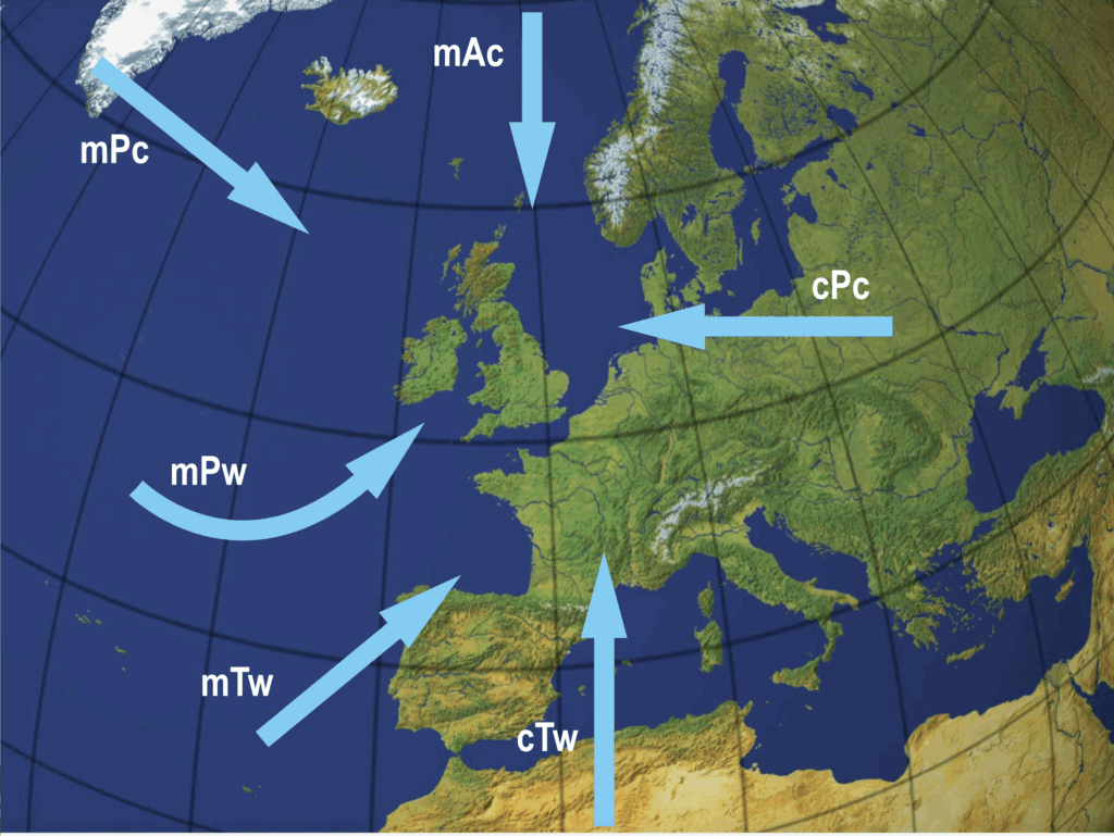
Classify air masses on a surface weather chart. Remark: Names and abbreviations of air masses used in examinations: first letter: humidity continental (c) maritime (m) second letter: type of air mass arctic (A) polar (P) tropical (T) equatorial (E) third letter: temperature cold (c) warm (w) (050.06.01.01.07)
| Track | Continental | c |
|---|---|---|
| Maritime | m | |
| Source region | Arctic | A |
| Polar | P | |
| Tropical | T | |
| Temperature | Warm | w |
| Cold | c |
Modifications of air masses (050.06.01.02)
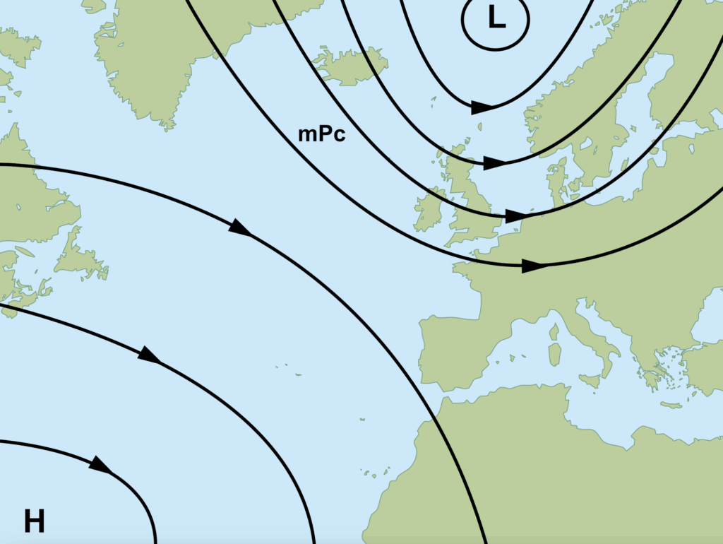
Maritime Polar Cold Air
Maritime polar cold (mPc) air starts over the polar cap as cold, dry, stable air.
As it moves south over the North Atlantic, it picks up moisture, the warmer seas heat up the lower levels and, as temperature is raised, more moisture is picked up. As such, the air mass becomes less stable while moving away from its source region.
The mPc air mass generally arrives at North-West Europe from the W and NW, as cool, moist and (conditionally) unstable air. The weather associated with it, is convective cloud, showers and good visibility (except in showers).
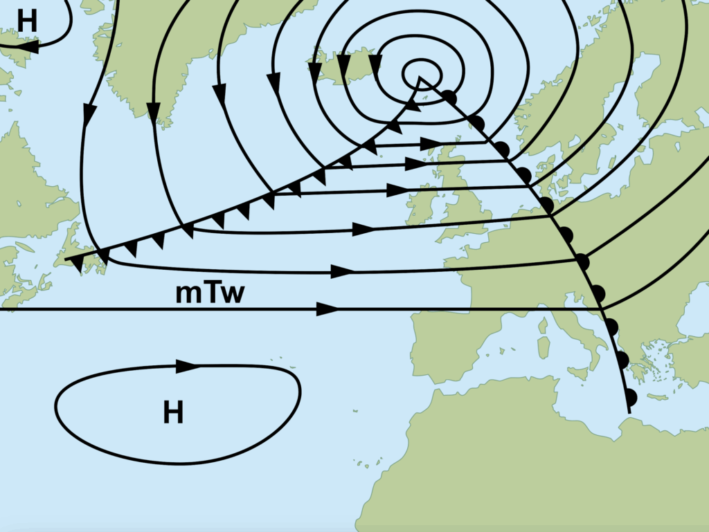
It reaches North-West Europe usually as the cold sector of a large polar front depression.
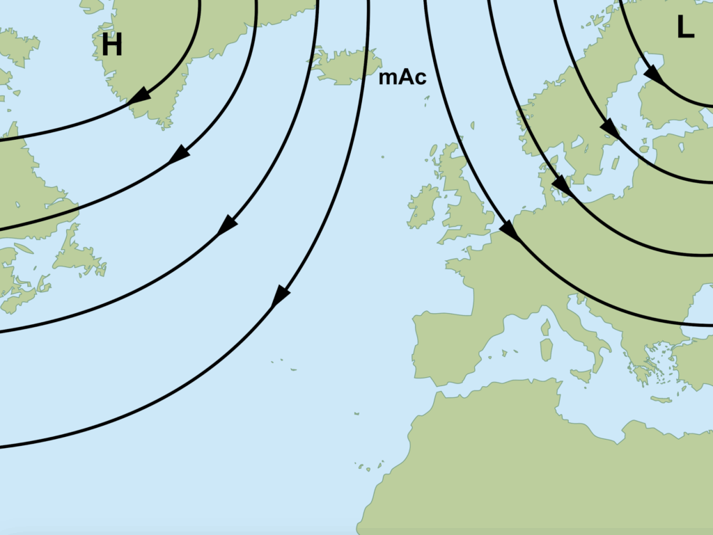
Maritime Arctic Cold Air
Maritime arctic cold (mAc) air mass is basically a more extreme version of the maritime polar cold (mPc) air mass, as it is coming directly from the Arctic ice cap.
Because of the bigger temperature contrast between the very cold air and the relatively warm open sea, makes Cu and Cb already form over sea and bringing heavy snowfall when arriving at land.
Maritime Tropical Warm Air
Maritime tropical warm (mTw) air starts over the warm, moist, stable Azores high. It reaches North-West Europe usually as the warm sector of a large polar front depression.